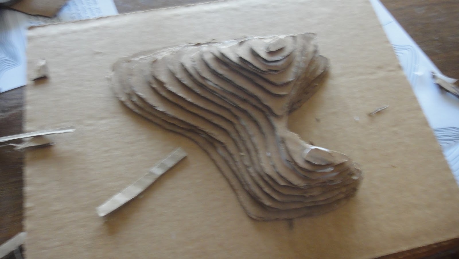
Our project was taken from The Sierra Club Wayfinding Book. We looked at an example of a topographical map, taken from the book, and talked about the useful information this kind of map provides, particularly for those going on a hike that would prefer to avoid a steep cliff. We talked about how the closer the contour lines are, the steeper the rise in elevation. Then, we took an example contour map and made a 3D version to really drive the usefulness of the map home.
The simple map we used was provided in the book. It consisted of 14 rises in elevation. I traced each of the contours onto cardboard and numbered them to coincide with the numbers on the map. The Club then had to cut them out and glue them in order, being sure to refer back to their map so that they could see where each contour needed to be placed in relation to the others.
This proved to be a challenging exercise for some of the Clubbers, as they had difficulty cutting the rigid cardboard. I asked those Clubbers to do their best to cut around the outside of the shapes and then I trimmed the edges as necessary while they glued the layers of the map. Others who were able to cut and paste on their own eventually made some modifications - a bridge here, a gondola there. Some mentioned taking it home to paint or decorate with trees at a later date.


Now, to finish cleaning up the scraps of cardboard that surround my table!
No comments:
Post a Comment